Driveline
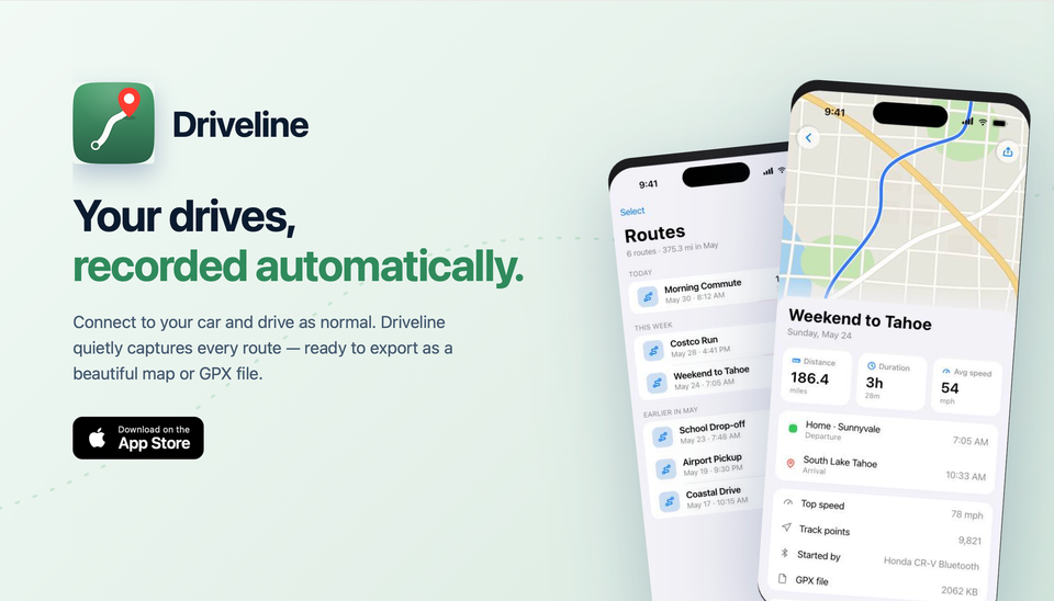
Your drives, recorded automatically.
Download on the App Store View on GitHubDriveline is a private, automatic drive tracker for iPhone. It starts recording when your car connects over Bluetooth or CarPlay, maps every route, captures weather and detailed stats, and exports clean GPX files and map images — with no account and no subscription.
Built for road trips
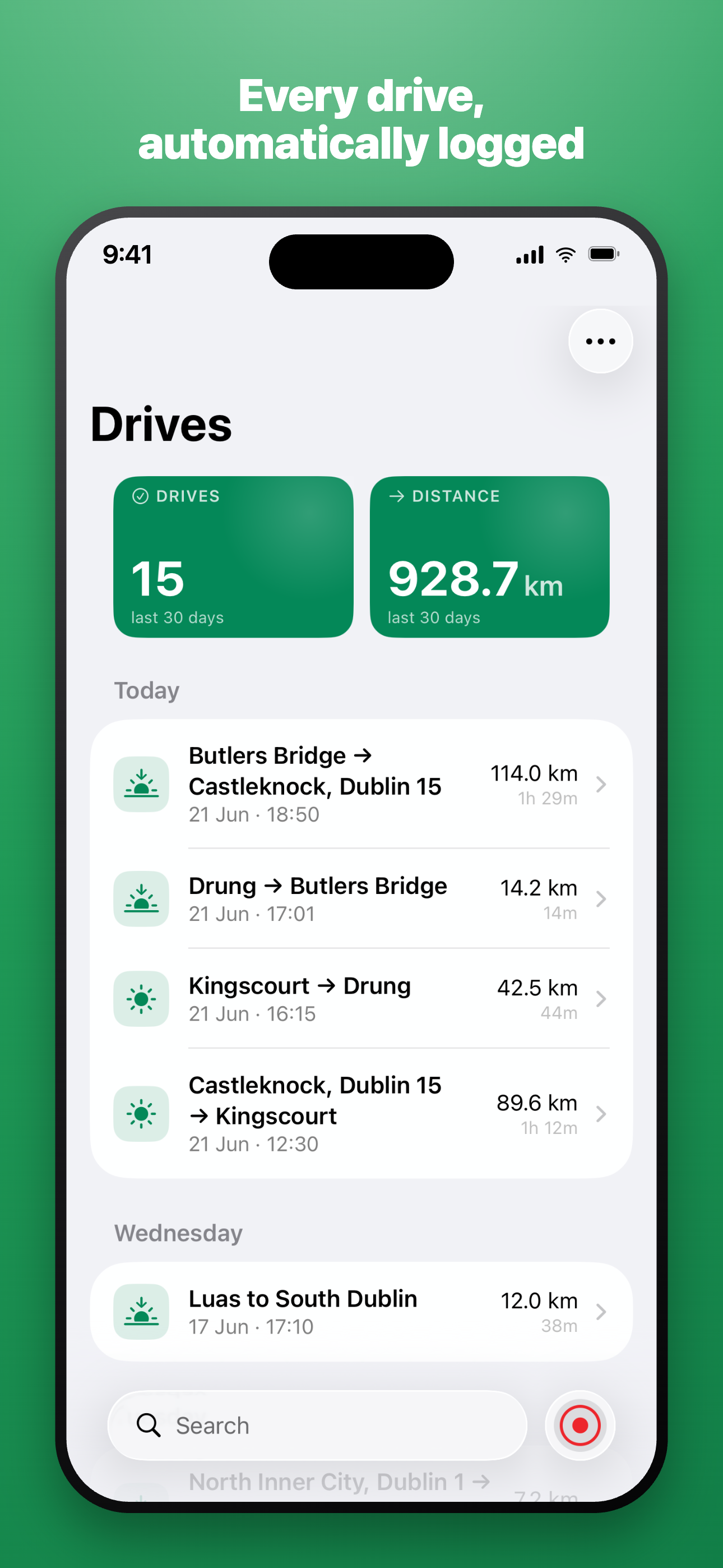
Every drive, automatically logged
Most tracking apps expect you to tap a button. Driveline expects you to drive. It starts the moment your car connects over Bluetooth or CarPlay, logs each trip from start to finish, and quietly stops when you arrive — no buttons to remember.
- Auto-resumes a drive if you set off again within 30 minutes of finishing.
- Auto-finishes a drive if you forget — so nothing is left running.
- Your Drives list groups trips by day with distance, duration and time of day.
- See your totals at a glance — drives and distance over the last 30 days.
- Search any drive by name, start point or destination.
How it works
Three steps, then it stays out of your way.
Connect
Set up a Shortcuts automation once, so Driveline starts and finishes with your car's Bluetooth or CarPlay connection.
Drive
Driveline records in the background to save battery. Your full drive map appears when the drive ends.
Review & export
Open any drive to see its route, stats and weather — then export it as a GPX file or a map image.
Drive detail
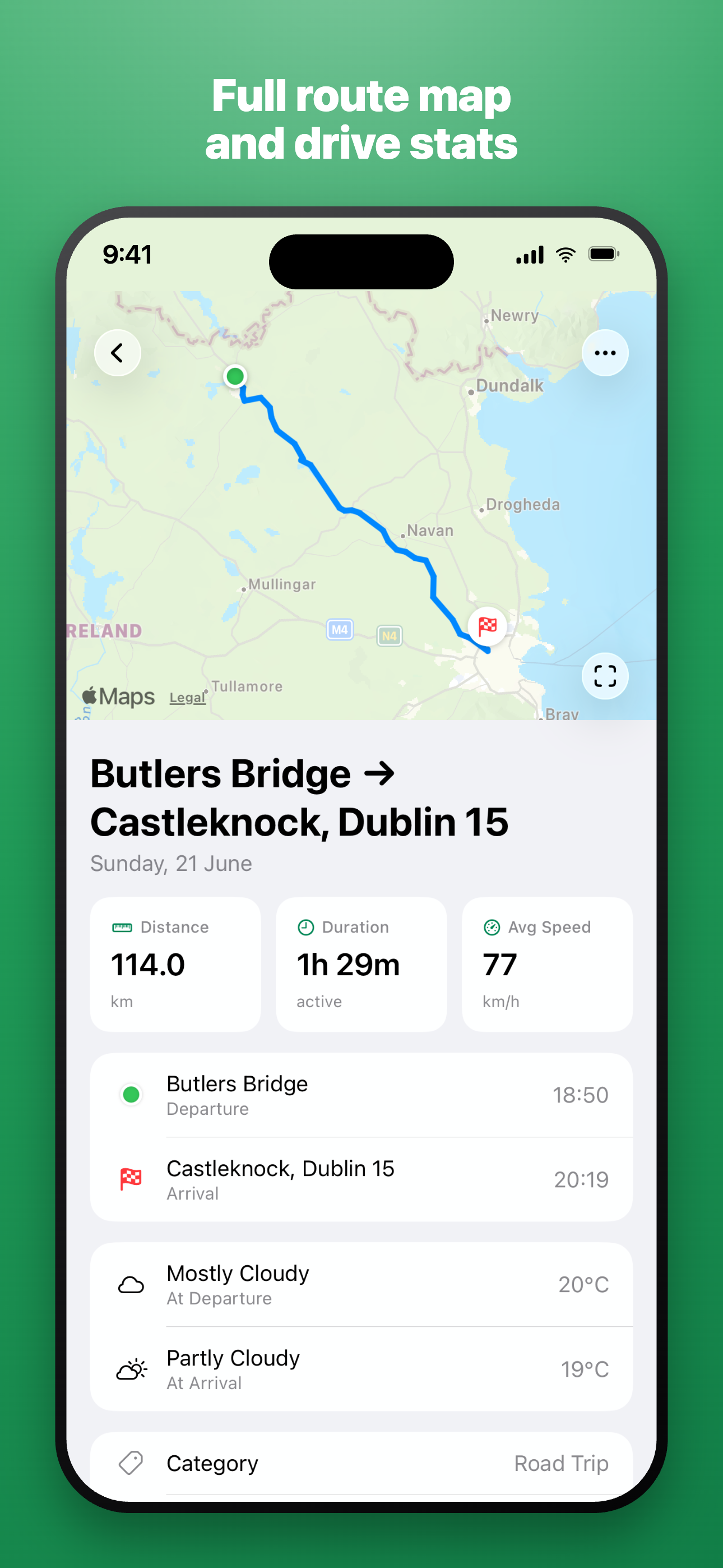
Full route map and drive stats
Every finished drive gets a full route map and a complete breakdown of how it went — distance, active driving time and average speed, with departure and arrival times and places.
Go deeper with extended statistics: top speed, track points, elevation gain and loss, stops, and route curvature — all calculated on device.
Weather, captured automatically
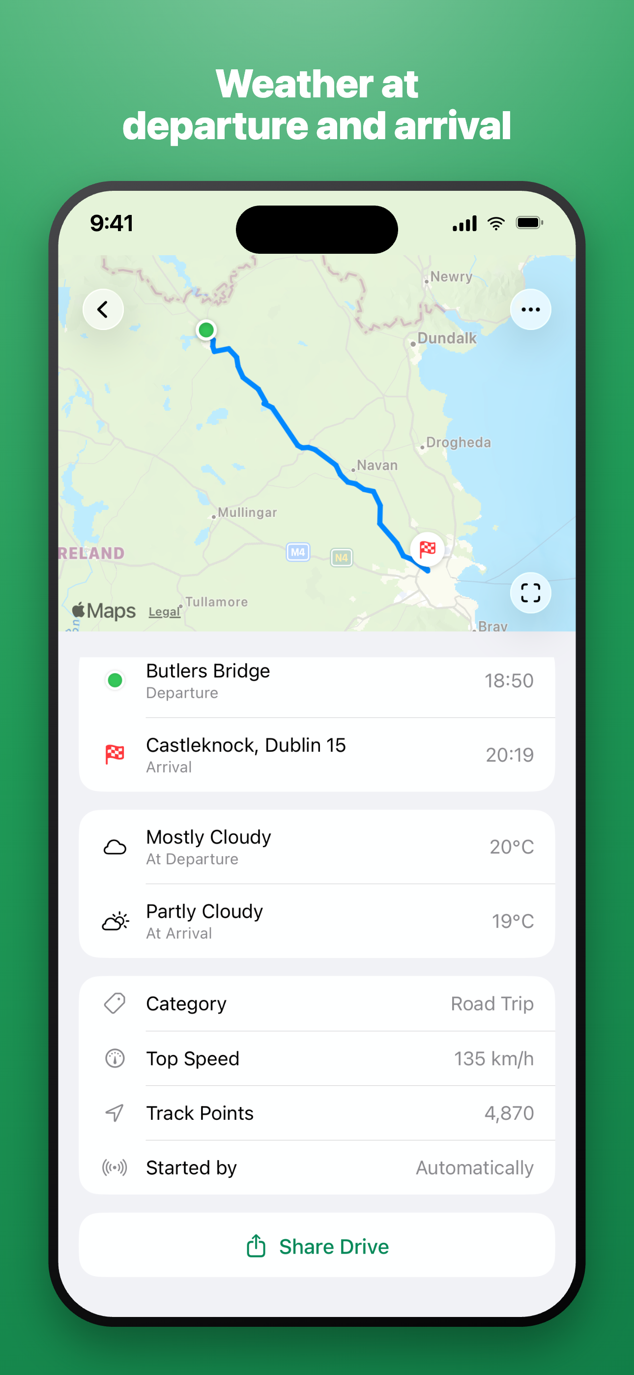
Weather at departure and arrival
Driveline records the conditions for both ends of your trip — for example Mostly Cloudy, 20°C at departure and Partly Cloudy, 19°C at arrival — using Apple Weather.
- Top Speed — e.g. 135 km/h.
- Track Points — e.g. 4,870 recorded GPS points.
- Started by — Automatically or manually.
- Share Drive — send the full trip straight from the detail screen.
Weather data provided by Apple Weather.
On-device intelligence
Smart drive categories
Driveline uses an on-device machine-learning model to sort each drive into a category automatically — and re-classifies older drives as the model improves. Nothing leaves your iPhone to make it happen.
Maps
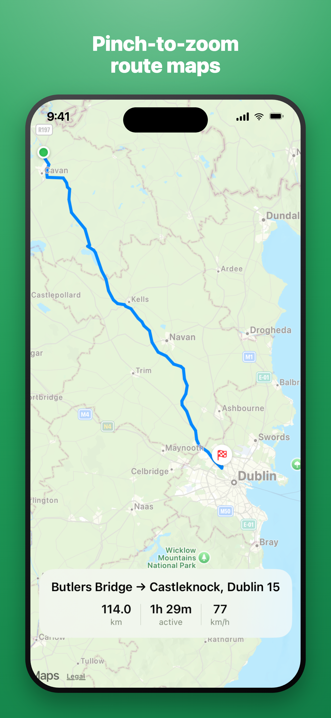
Pinch-to-zoom route maps
Open any drive into a full-screen, interactive map. Pinch to zoom from the whole journey down to a single junction, with start and finish place names marked and a summary of distance, duration and average speed always in view.
While you drive
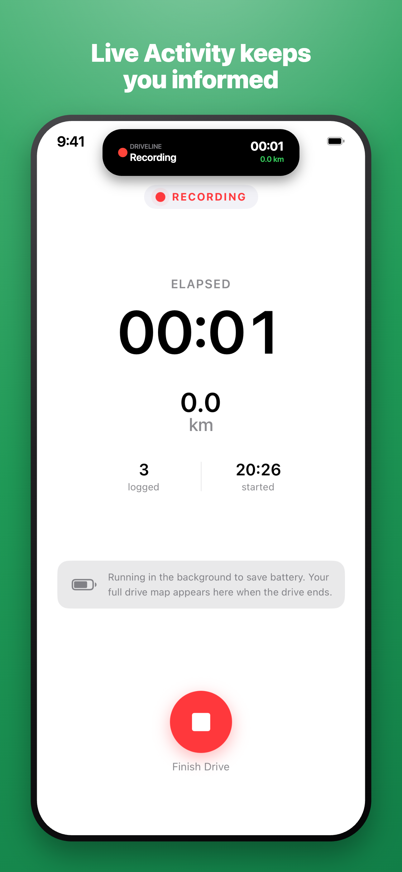
Live Activity keeps you informed
A Live Activity on your Lock Screen and in the Dynamic Island shows your drive in progress — elapsed time, distance and a Finish Drive button you can reach without unlocking.
The recording screen stays deliberately simple. As it says in the app: “Running in the background to save battery. Your full drive map appears here when the drive ends.”
Export anywhere
GPX files
Export the full route as a standard GPX file, including speed, elevation and a timestamp for every point, plus Driveline's own statistics and weather as extensions. Works with Strava, Komoot, RideWithGPS, QGIS and more.
Map images
Export a clean PNG map of your route with start and finish markers. Choose the image size, route line width and a light or dark map style — then share it from the standard iOS share sheet.
Privacy first
Private by design
Your drives live on your device. Turn on iCloud for private, encrypted sync across your devices — with no Driveline account, ever. No sign-up, no subscription, no ads and no third-party tracking. Location is used only to record your drives; coordinates go to Apple Maps and Apple Weather solely to fetch place names and conditions.
Designed for iPhone
Built for iOS
A native SwiftUI app for iOS 26 and later. Driveline works with Siri & Shortcuts, indexes your drives in Spotlight search, and is fully localised in English, French, German and Dutch. It's open source under the MIT License.